You’re moving to Austin and you don’t want to buy a car. Maybe you’re relocating from Chicago, Portland, or New York, where you’ve never needed one. Maybe you’re trying to cut $10,000+ per year in car ownership costs. Or maybe you just hate driving in Austin traffic (and honestly, we can’t blame you).
Here’s what nobody is telling you: most “transit-accessible” apartment listings in Austin are marketing fiction.
A renter paying $1,200/month in Cedar Park plus $800/month in car costs is spending more than a renter paying $1,500/month in Hyde Park with a $41 bus pass. The math works, but only if you pick the right corridor. Pick wrong, and you end up car-free in a neighborhood where the nearest grocery store is a 25-minute walk and the bus comes twice an hour.
Our team places renters along Austin’s transit corridors every week. We mapped these corridors to specific apartment options, station by station, line by line, with rent data, commute times, and the honest frequency limitations that no other apartment guide publishes. This is the resource we wish existed when our clients started asking us “Can I actually live here without a car?”
Austin’s Transit Reality: What You’re Working With
Before diving into specific corridors, you need to understand what CapMetro actually offers. Austin’s transit system has improved, but it still operates like a system designed around the assumption that everyone drives.
| Service | Route | Frequency (Peak) | Frequency (Off-Peak) | Coverage |
|---|---|---|---|---|
| MetroRail Red Line | Downtown to Leander (32 mi, 10 stations) | Every 30-37 min | Every 60 min / None Sunday | Northwest corridor only |
| MetroRapid 801 | N Lamar to S Congress via downtown | Every 10-15 min | Every 15-20 min | North-south central spine |
| MetroRapid 803 | Burnet to S Lamar via downtown | Every 10-15 min | Every 15-20 min | West-central north-south |
| MetroRapid 801/803 | Downtown shared | Combined every 5-8 min | Combined every 8-12 min | Downtown core |
| Local Bus Network | 55+ routes citywide | Every 15-60 min | Varies widely | Broad but infrequent |
| CapMetro Pickup | On-demand zones | On-demand | On-demand | Limited zones only |
Source: CapMetro schedules and Transit Plan 2035, approved October 2025
Two routes carry the system. MetroRapid 801 and 803 run frequently enough to be useful for daily life — not just commuting. MetroRail works for a downtown commute but fails as a full transit solution. Everything else is supplemental.
A CapMetro day pass costs $2.50 for local/Rapid service and $7 for commuter service including MetroRail. A monthly local pass runs $41.25, and a commuter pass is $96.25.
The late-night gap you need to know about: CapMetro runs Late Night service (Routes 481-486) until about 2-3 AM on Thursday, Friday, and Saturday nights, covering key corridors like 6th Street, South Congress, and North Lamar. That’s legitimately useful for going out on weekends. But Sunday through Wednesday, most bus service ends by 11 PM to midnight, and MetroRail’s last weeknight train leaves downtown around 7:20 PM. If you’re at a dinner that runs past service hours on a Tuesday? You’re calling a rideshare. Budget accordingly. This is the single biggest gap between Austin’s transit and what you’re used to in a real transit city.
Employer shuttles worth checking: Several major Austin employers run private shuttle services that fill CapMetro’s gaps. Apple operates shuttles between its Parmer Lane campus and central Austin. Other large tech employers in the Domain and North Austin area often offer similar programs, so check with your HR department. UT Austin’s shuttle system is extensive, free for students and staff, and open to the public at standard CapMetro fares. If you work for a large Austin employer, ask whether they run shuttles before you write off a neighborhood as “too far.” An employer shuttle can completely change the car-free equation for your specific commute.
MetroRail Red Line: Station-by-Station Apartment Guide
CapMetro’s Red Line covers 32 miles from downtown Austin northwest to Leander, stopping at 10 stations. It’s a commuter rail line built on existing freight tracks, not a subway or light rail system. That distinction matters.
What it does well: Gets you from the suburbs to downtown for work. Trains run roughly every 30-37 minutes during peak hours (currently; double-tracking improvements will eventually bring this to 15 minutes). It’s reliable, comfortable, and avoids I-35 entirely.
What it doesn’t do: Run frequently enough for spontaneous trips. The last train from downtown on weeknights departs around 7:20 PM. No Sunday service. If you miss a train, you’re waiting 30+ minutes or calling a rideshare.
Bottom line: If you work downtown and commute during standard hours, the Red Line can replace a car for that trip. But you still need a car (or at minimum a solid bike + rideshare budget) for everything else.
| Station | Distance to Downtown | Ride Time | Walkable Apartments (0.5 mi) | 1BR Rent Range | Walk Score |
|---|---|---|---|---|---|
| Downtown | — | — | 50+ properties | $1,800–$3,500+ | 90 |
| Plaza Saltillo | 1 mi east | 3 min | 20+ properties | $1,400–$2,400 | 81 |
| MLK Jr. | 1.5 mi east | 5 min | 10-15 properties | $1,200–$1,900 | 68 |
| Highland | 4 mi north | 12 min | 15+ properties | $1,300–$2,100 | 62 |
| Crestview | 5 mi north | 14 min | 8-10 properties | $1,200–$1,800 | 58 |
| McKalla | 5.5 mi north | 16 min | 10-12 properties | $1,400–$2,200 | 55 |
| Kramer | 6.5 mi north | 19 min | 8-10 properties | $1,300–$2,000 | 48 |
| Howard | 11 mi north | 27 min | 5-8 properties | $1,200–$1,700 | 35 |
| Lakeline | 18 mi north | 38 min | 3-5 properties | $1,100–$1,500 | 25 |
| Leander | 25 mi north | 52 min | 2-3 properties | $1,000–$1,400 | 20 |
Rent ranges reflect 1BR apartments as of early 2026. Walk Scores are approximate for the station area. Properties within 0.5 miles of each station.
The station-by-station reality:
Downtown and Plaza Saltillo are the only two stations where you can realistically go car-free using the Red Line as your primary transit mode. Both stations sit within walkable neighborhoods with grocery stores, restaurants, and MetroRapid connections for non-commute trips. Plaza Saltillo is in East Austin’s core, one of the most walkable neighborhoods in the city. Communities within walking distance include The Rail at MLK (newer construction, studios from ~$1,400), Corazon and Saltillo Lofts in the Plaza Saltillo TOD development, and several mid-rise options along East 5th and East Cesar Chavez.
MLK Jr. and Highland offer a hybrid option. Both station areas have enough density and bus connections that car-light living works if you pair the Red Line with a bike and occasional rideshare. Highland sits near the ACC campus and Mueller, a planned walkable community with its own transit center and multiple bus connections. Apartment options here include communities in the Mueller development and several properties near the ACC Highland campus along Airport Boulevard.
Crestview punches above its weight. It sits where the Red Line crosses the 801/803 bus corridors, giving it one of the better multi-modal connections outside downtown. Burnet Road’s restaurant scene is growing fast right next door, and rents here are still reasonable. We cover it again in the 801 section below.
McKalla is the newest station, opened in 2024 adjacent to Q2 Stadium. The surrounding North Burnet area is rapidly developing. A new North Burnet/Uptown station is under construction near The Domain, expected to open around 2027. But right now, the area between McKalla and The Domain remains car-dependent for daily errands despite technically being “near” a rail station.
Kramer through Leander — let’s be direct. These stations function as Park & Rides. You drive to the station, park, and ride the train downtown. Living near these stations without a car isn’t practical. Howard has a Walk Score of 35. Lakeline is 25. Leander is 20. You can’t walk to a grocery store from any of them.
MetroRapid 801: The Best Transit Corridor in Austin
If you’re committed to car-free or car-light living in Austin, the MetroRapid 801 corridor is where to focus your apartment search. Period.
Route 801 runs from the Tech Ridge Park & Ride in far north Austin, down North Lamar Boulevard through Hyde Park and the UT campus, through downtown, and south along South Congress to Southpark Meadows. It’s CapMetro’s highest-ridership route, and it runs frequently enough (every 10-15 minutes during peak, every 15-20 minutes off-peak) to function like actual urban transit rather than a commuter shuttle.
Along this corridor, you’ll find Austin’s densest, most walkable neighborhoods. And the apartment options along it range from student housing at $800/room near UT to luxury high-rises downtown at $3,500+.
| Corridor Segment | Key Stops | 1BR Rent Range | Walk Score | Bus Frequency | Car-Free Viable? |
|---|---|---|---|---|---|
| Tech Ridge / Rundberg | Tech Ridge P&R, Rundberg | $900–$1,400 | 35-50 | Every 12-15 min | No — car needed for errands |
| North Lamar / Crestview | Justin Ln, Crestview | $1,100–$1,600 | 55-65 | Every 10-15 min | Car-light possible |
| Hyde Park / North Loop | 45th St, Guadalupe | $1,200–$1,800 | 75-85 | Every 10 min | Yes |
| UT / West Campus | UT campus, Guadalupe | $800–$1,500 (per room–per unit) | 88-95 | Every 8-10 min | Yes |
| Downtown | Republic Square, Congress | $1,800–$3,500+ | 90-96 | Every 5-8 min (801+803) | Yes |
| SoCo / South Congress | S Congress at Oltorf, SoCo | $1,400–$2,200 | 70-82 | Every 10-15 min | Yes (core SoCo) |
| South Congress Extended | Stassney, Southpark Meadows | $1,000–$1,500 | 30-45 | Every 15-20 min | No |
Rent ranges reflect 1BR apartments as of early 2026. Walk Scores are approximate by corridor segment.
Where the 801 corridor actually supports car-free living:
Your best bet runs from Hyde Park through downtown and down to the South Congress core. That’s roughly a 6-mile stretch where Walk Scores stay above 70, the bus comes every 10-15 minutes, and you can walk to groceries, dining, and daily essentials.
Hyde Park stands out as a value play. It’s residential, tree-lined, and walkable to both the 801 on Guadalupe and the North Loop commercial district. One-bedroom apartments range $1,200–$1,800, well below downtown pricing, and the 801 gets you to downtown in about 15 minutes. Look at properties along Guadalupe and Duval streets. Several smaller boutique properties and mid-rise communities dot this neighborhood.
South Congress between the river and Oltorf is Austin’s most iconic walkable corridor. Restaurants, shops, and bars line the street, and the 801 connects you to downtown in under 10 minutes. The trade-off: 1BR rents run $1,400–$2,200, and you’re paying a walkability premium. Several mid-rise developments along South Congress and South 1st put you steps from the 801 stops.
If your budget is tight, consider the Crestview area along North Lamar. It’s on the 801 corridor, has a growing number of restaurants and shops along Burnet Road (also served by the 803), and 1BR rents still start around $1,100. Properties in the Brentwood and Allandale areas along this stretch include a mix of newer mid-rise and older garden-style communities that offer solid value. You’ll want a bike to supplement transit, but car-free living is doable with some planning.
Need help narrowing down which part of the 801 corridor matches your budget and commute? Call our team at (512) 360-0852. We match renters to transit-friendly apartments daily.
MetroRapid 803: The Western Corridor
Route 803 covers Austin’s western north-south spine: from The Domain down Burnet Road, through the UT campus area, through downtown, and south along South Lamar to Westgate.
It mirrors the 801 in frequency (every 10-15 minutes peak) and overlaps with it through downtown and the university area. But the surrounding neighborhoods have a different character.
| Corridor Segment | Key Stops | 1BR Rent Range | Walk Score | Car-Free Viable? |
|---|---|---|---|---|
| The Domain | Domain Dr, Braker | $1,700–$2,800 | 65-78 (Domain core) | Car-light at best |
| Burnet Road / Allandale | Anderson Ln, Burnet Rd | $1,200–$1,700 | 50-65 | Car-light possible |
| UT / Drag | Guadalupe St campus area | $800–$1,500 | 88-95 | Yes |
| Downtown | Shared with 801 | $1,800–$3,500+ | 90-96 | Yes |
| South Lamar | S Lamar at Barton Springs, Oltorf | $1,400–$2,000 | 60-75 | Yes (close to S Lamar core) |
| South Lamar Extended | S Lamar at Manchaca, Westgate | $1,100–$1,600 | 35-50 | No |
Rent ranges reflect 1BR apartments as of early 2026.
Corridor highlights:
Burnet Road has transformed over the past five years into one of Austin’s best restaurant corridors. Apartments in the Allandale and Brentwood areas along Burnet offer a balance of walkability and affordability that’s hard to beat. The 803 connects you to downtown in 20-25 minutes, and the corridor has enough coffee shops, grocery options (H-E-B on Burnet), and dining that daily errands don’t require a car.
South Lamar is another strong option, especially the stretch between Barton Springs Road and Oltorf. It’s packed with restaurants, has H-E-B and Trader Joe’s access, and connects to downtown via the 803 in about 15 minutes. Rents run $1,400–$2,000 for a 1BR, which reflects the walkability and dining scene.
Now, The Domain. We need to be honest here. Yes, the 803 stops there. And yes, the Domain itself has a Walk Score in the upper 70s within its retail core. But it’s a curated shopping district, not a complete neighborhood. Outside the retail core, Walk Scores drop to the 40s-50s. There’s no full-service grocery store within the walkable retail core around Rock Rose and Domain Drive (the nearest H-E-B is at Braker and Stonelake, a 15-25 minute walk outside the pedestrian loop). Getting anywhere else without a car takes 30+ minutes by bus. Car-light is possible if your life revolves around The Domain. Car-free? Not realistic.
Project Connect Light Rail: Should It Affect Your Lease Decision?
Austin voters approved Project Connect in 2020. It includes two light rail lines (Blue and Orange), improvements to the Red Line, and expanded bus service. The first phase of light rail (about 10 miles running from 38th Street through downtown and splitting to South Congress/Oltorf and East Riverside) received FTA environmental approval in January 2026. Construction is expected to start in 2027 with service projected to begin in 2033.
| Milestone | Status (as of early 2026) |
|---|---|
| Voter approval | November 2020 ✓ |
| Environmental review (NEPA) | Completed January 2026 ✓ |
| Design-build contract (Phase 1A) | Awarded February 2026 ✓ |
| FTA New Starts Engineering approval | Expected 2026 |
| Full Funding Grant Agreement | Expected 2027 |
| Construction begins | Expected 2027 |
| Revenue service (trains running) | Projected 2033 |
Sources: Austin Transit Partnership, FTA Record of Decision January 2026
What the light rail will cover (Phase 1):
- North section: 38th Street south through UT campus along Guadalupe Street to downtown
- South section (Orange Line): Downtown south along South Congress to Oltorf
- East section (Blue Line): Downtown east along East Riverside Drive to near Austin-Bergstrom Airport
Trains will run every 5-10 minutes during the day on shared track sections, every 10 minutes on individual branches.
Should this affect your lease decision?
Signing a 12-month lease? No. Construction hasn’t started. Service is seven years away. Sign wherever makes sense today.
Thinking longer-term? Maybe. If you’re planning to stay in Austin 5+ years and want to buy a home or commit to a neighborhood, the corridors where light rail stations are planned (South Congress, East Riverside, Guadalupe through UT and downtown) will see transit access transform dramatically by the early 2030s. East Riverside in particular could shift from car-dependent to genuinely transit-accessible when light rail connects it to downtown and the airport.
But there’s a “maybe” in that “maybe.” The project faces ongoing litigation about its financing structure, with the Texas Supreme Court hearing arguments in early 2026 (check current status before relying on this timeline). Federal funding covers roughly half of the $7.1 billion cost. Political shifts at the state or federal level could affect timelines. Plan for the transit system Austin has, not the one it might build.
The Honest Car-Free Assessment: Where It Works and Where It Doesn’t
Every other apartment guide skips this part. We’re not going to. Below is a neighborhood-by-neighborhood breakdown of where car-free living actually works in Austin and where the listing is selling you a fantasy.
| Neighborhood | Walk Score | Transit Score | Car-Free Viable? | Reality Check |
|---|---|---|---|---|
| Downtown (78701) | 90 | 68 | Yes | Full grocery, dining, transit access. Expensive ($1,800-$3,500+ 1BR) but functional car-free living. |
| West Campus | 88 | 72 | Yes | Student-oriented but very walkable. UT shuttles + MetroRapid. Rent $800-$1,500 (per room to per unit). |
| East Cesar Chavez / Holly | 81 | 54 | Mostly yes | Walkable to groceries and dining. Good bike infrastructure. Bus connections less frequent than 801/803. |
| Hyde Park | 78 | 55 | Yes with bike | 801 corridor. Walkable commercial on Guadalupe and North Loop. Need a bike for some errands. |
| SoCo / South Congress core | 75-82 | 52 | Yes | 801 corridor. Walkable dining/retail. H-E-B accessible. Premium pricing. |
| North Loop / North University | 80 | 60 | Yes with bike | Near UT, 801 access, growing commercial. Bike extends your range. |
| South Lamar core | 68 | 48 | Car-light | 803 corridor. Walkable to restaurants/groceries in core. Bike needed for some trips. |
| Mueller | 65 | 45 | Car-light | Walkable within Mueller. Good bus connections via Route 350. Limited late-night options. |
| The Domain | 65-78 (core) | 42 | No | Walkable within the retail center. Not a complete neighborhood. No nearby grocery in walking core. Car needed. |
| East Riverside | 55 | 40 | No (today) | Improving with development. Limited walkable retail. Future light rail will change this by 2033. |
| SE Austin / Riverside south | 40 | 30 | No | Bus service is infrequent. Strip-mall retail. Car required. |
| Round Rock / Cedar Park | 25-35 | 15-20 | No | Suburban. MetroRail accessible from Leander/Lakeline stations but only for downtown commute. |
Walk and Transit Scores are approximate, reflecting station area averages. Scores vary block by block.
The pattern is clear: Car-free living in Austin is concentrated in a roughly 4-mile radius from downtown. Once you push past that (north of Highland, south of Oltorf, east of Pleasant Valley, west of MoPac), you’re in car-dependent territory regardless of what the apartment listing says.
No shame in needing a car here. Over 70% of Austin commuters drive solo, per Census commuting data. But if you’re coming from a transit city and want to maintain that car-free lifestyle, stick to the neighborhoods marked “Yes” in the table above. Anything else requires honest self-assessment about how you’ll get groceries at 9 PM on a Tuesday.
Need help finding apartments in the car-free zones that match your budget? Our team specializes in Austin’s walkable corridors. Call (512) 360-0852 or start with our search tool. It filters by location along transit routes so you’re not wading through suburban listings.
The Grocery Test: Can You Feed Yourself Without a Car?
Here’s the test we apply when renters ask us whether a neighborhood is “really” car-free: can you walk to a full-service grocery store? Not a convenience store. Not a gas station with milk. A real grocery store where you can buy produce, meat, and a week’s worth of food.
| Transit Corridor / Neighborhood | Nearest Full-Service Grocery | Walk Time | Notes |
|---|---|---|---|
| Downtown | Whole Foods (5th & Lamar) | 5-15 min depending on location | Also Trader Joe’s on S Lamar (walkable from south downtown). H-E-B at 7th & Pleasant Valley is bikeable. |
| Plaza Saltillo / East Cesar Chavez | H-E-B (East 7th & Pleasant Valley) | 10-20 min | Solid full-service H-E-B. Also Fiesta Mart on East Riverside within biking distance. |
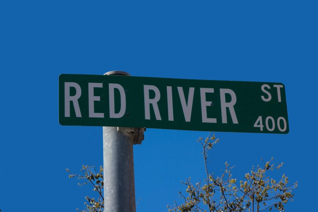
| Hyde Park | H-E-B (41st & Red River) | 5-15 min | Smaller format but complete. Fresh Plus Grocery on Duval is an excellent walkable option. |
| West Campus | H-E-B (41st & Red River) or Wheatsville Co-op (Guadalupe) | 10-15 min | Wheatsville is pricier but right on the Drag. |
| SoCo / South Congress | H-E-B South Congress (at Oltorf) | 5-15 min | Full-service H-E-B. Walkable from most SoCo apartments. |
| South Lamar core | H-E-B (S Lamar & Oltorf) + Trader Joe’s (S Lamar) | 5-10 min | Two good options within walking distance. This is one of South Lamar’s biggest car-free advantages. |
| Burnet / Allandale | H-E-B (Burnet & Koenig) | 5-15 min | Well-stocked. Also Sprouts on Burnet Rd within biking distance. |
| North Loop | Fresh Plus (Duval) + H-E-B (41st) | 5-10 min | Small but functional. |
| Mueller | H-E-B Mueller (Aldrich St) | 5-10 min within Mueller | Designed into the neighborhood. One of Mueller’s best car-free features. |
| The Domain | H-E-B (Braker & Stonelake) | 15-25 min walk | Not walkable from the Domain’s retail core. This is the car-free dealbreaker. |
| Crestview | H-E-B (Burnet & Koenig) | 10-20 min | Walkable from eastern Crestview, bikeable from western. |
Walk times assume a starting point near the center of each neighborhood. Your specific apartment location will vary.
If a neighborhood doesn’t have a walkable grocery store, you’re eventually going to need a car — or you’re spending $15-$20 on rideshare every time you restock your fridge. The neighborhoods that pass this test are the same ones we flag as car-free viable. That’s not a coincidence.
Bike Infrastructure: What’s Actually Rideable Year-Round
On paper, Austin’s bike infrastructure is impressive. The city’s All Ages and Abilities (AAA) bicycle network now exceeds 215 miles of protected lanes, neighborhood bikeways, and trails, with a $460 million voter-approved bond (2020) funding expansion toward a 1,200-mile vision.
On the ground? It’s more complicated. Austin is hot. July through September, afternoon temperatures regularly exceed 100°F. Biking to work in business clothes at 2 PM in August isn’t happening for most people.
| Corridor | Protection Level | BCycle Stations | Year-Round Commute Viable? | Best For |
|---|---|---|---|---|
| Ann & Roy Butler Trail (Lady Bird Lake loop) | Fully separated trail (10 mi) | 15+ stations | Yes (flat, shaded sections) | Recreation + east-west connection |
| Shoal Creek Blvd | Protected lanes + trail | 5-8 stations | Yes (shaded, residential) | North-south central commute |
| Rio Grande / Nueces | Protected lanes downtown | 8+ stations | Yes (short distances) | Downtown circulation |
| Congress Avenue | Protected lanes (improving) | 5+ stations | Yes (flat, direct) | Downtown to SoCo |
| Lance Armstrong Bikeway | Protected / mixed | 3-5 stations | Yes | Downtown to East Austin |
| Guadalupe / Drag | Bike lanes (mixed protection) | 5+ stations | Spring/fall only | UT campus to North Loop |
| East Cesar Chavez | Bike lanes (improving) | 3-4 stations | Yes (flat terrain) | East Austin circulation |
| South Lamar | Buffered lanes (not fully protected) | 3-4 stations | Experienced cyclists only | South-central connection |
BCycle station counts are approximate. CapMetro operates BCycle as Austin’s public bike-share system. E-bikes available.
The realistic bike assessment:
Biking works as a transit supplement in Austin for roughly 9 months of the year. October through June, conditions are manageable with proper hydration and route planning. July through September, plan bike trips for early morning or evening only, or stick to the shaded trail corridors (Lady Bird Lake loop, Shoal Creek).
Best corridors for bike commuting: Shoal Creek (north-south through central Austin), the Lady Bird Lake trail (east-west connector), and the Congress Avenue protected lanes (downtown to SoCo). Live along any of these and work within 5 miles? Biking can legitimately replace a car for daily commuting most of the year.
BCycle e-bikes extend your effective range to 8-10 miles per trip and flatten Austin’s hills. Stations cluster in downtown, UT, East Austin, and the South Congress/South Lamar corridors. Monthly BCycle memberships run about $13, a fraction of a car payment.
Rain, heat, and the plan B you need: Austin doesn’t rain often, but when it does, it rains hard. Flash flooding is a real thing here, especially May through June and September through October. A sudden 2-inch downpour can turn bike lanes into streams and leave you stranded at an unsheltered bus stop. Most MetroRail stations have covered platforms, but many MetroRapid stops along the 801 and 803 have minimal shelter (a bench and a sign, not a roof). Bottom line: always have a rideshare app loaded on your phone as your weather Plan B. Budget $30-$50/month extra during peak storm months if you’re primarily bike-dependent. And never cross a flooded road on a bike. Austin takes “Turn Around, Don’t Drown” seriously for good reason.
Heat is the other variable. We mentioned the July-September window, but let’s be specific: Austin regularly hits 100°F+ from June through September, and recent summers have logged 20+ days above that mark. Morning commute biking (before 9 AM) is manageable year-round. Evening rides after 7 PM are fine. But the 2 PM bike ride from South Lamar to downtown? That’s a sweat-soaked arrival unless your office has a shower. Plan your routes around morning departures and return via transit in the afternoon heat, or stick to the shaded corridors (Shoal Creek, Lady Bird Lake trail) where tree cover drops temperatures by 5-10 degrees.
What Car-Free Living Actually Costs in Austin
One of the strongest arguments for choosing a transit-friendly corridor is the math. Ditching a car saves serious money — even if you pay higher rent for a walkable location.
| Monthly Expense | Car Owner (Suburban Apartment) | Car-Free (Transit Corridor) |
|---|---|---|
| Rent (1BR) | $1,200 (Cedar Park/Pflugerville) | $1,500 (Hyde Park/Crestview) |
| Car payment | $400 | $0 |
| Insurance | $150 | $0 |
| Gas | $150 | $0 |
| Parking | $0-$75 | $0 |
| Maintenance | $100 | $0 |
| CapMetro pass | $0 | $41.25 (local) |
| BCycle membership | $0 | $13 |
| Rideshare budget | $20 | $100 |
| Total monthly | $2,020-$2,095 | $1,654 |
| Annual | $24,240-$25,140 | $19,850 |
Car ownership costs based on AAA’s Your Driving Costs study ($12,297/year average for new vehicle in 2024). Rent ranges reflect average 1BR in each area. Rideshare budget covers occasional trips outside transit corridors.
Look at the bottom line. Car-free living wins by $370-$440/month, even after paying $300/month more in rent for a transit-accessible location. Over a 12-month lease, that’s $4,400-$5,300 back in your pocket.
And that doesn’t account for time. Spending 45 minutes each way from Cedar Park versus 20 minutes on the 801 from Hyde Park adds up to 50 extra minutes per day, over 200 hours per year. For a professional earning $80,000+, those hours have real economic value.
The caveat: this math only works if you actually commit to not having a car. A car sitting in a garage “just in case” costs you insurance, registration, and depreciation whether you drive it or not.
Your rideshare budget, broken down: We listed $100/month for rideshare in the car-free column. Here’s what that actually buys:
| Trip | Estimated Uber/Lyft Cost | Frequency for Car-Free Renter |
|---|---|---|
| Hyde Park to The Domain | $18-$25 | 1-2x per month |
| SoCo to Austin-Bergstrom Airport | $20-$30 | 1x per month (if you travel) |
| Downtown to East Riverside | $10-$15 | 2-3x per month |
| Hyde Park to Target (north) | $12-$18 | 2x per month |
| Late-night 6th Street to Hyde Park | $12-$20 (surge pricing possible) | 2-4x per month |
| Grocery run in bad weather | $8-$12 | 1-2x per month |
Prices reflect typical non-surge Uber/Lyft rates in Austin as of early 2026. Surge pricing during events (SXSW, ACL, UT game days) can double or triple these.
At $100/month, you get roughly 6-8 rideshare trips. That’s enough if you’re disciplined — use transit and bikes for daily life, save rideshare for the gaps. Some months you’ll come in under $100. Event weekends with surge pricing can blow through $100 in a single night. Renters who successfully stay car-free in Austin typically set a firm monthly rideshare budget and treat it like a utility bill.
Your First 30 Days Car-Free in Austin: The Setup Playbook
If you’ve just moved to Austin from a transit city and you’re going car-free, your first month determines whether this works long-term or turns into a frustrating experiment. Here’s the setup, in order of priority.
Week 1: The essentials
Download the CapMetro app (for fare purchase and route planning) and the Transit app (for real-time arrival data, often more accurate than CapMetro’s own tracker). Load a 7-day local pass on day one ($11.25) so you can explore without thinking about per-ride costs.
Walk to your nearest full-service grocery store and time it. If it’s under 15 minutes, you’re good. If it’s over 20 minutes, you’ll need a bike or you’ll eventually break down and call a rideshare every time you need milk. Check our grocery proximity table above for your neighborhood.
Locate your two closest MetroRapid stops (801 and/or 803). Time the walk from your apartment. If you’re within 5 minutes of a MetroRapid stop, your daily transit experience will be solid. If you’re 10+ minutes away, a bike becomes essential.
Week 2: The infrastructure
Sign up for a BCycle membership (around $13/month — check capmetro.org/bike for current pricing). Find your nearest BCycle station. Most of the car-free neighborhoods have one within a 5-minute walk. E-bikes are available and worth the small upcharge for hills and longer trips. Use it for trips that are too far to walk and too short or inconvenient for the bus.
Set up Uber and Lyft accounts if you haven’t already. Add a payment method and set a monthly budget alert at $100. This is your bad-weather and late-night backup, not your daily transportation.
Do a test commute to your workplace during the hours you’d actually be commuting. Time it door to door. If it’s under 40 minutes, that’s competitive with Austin car commute times (given I-35 and MoPac congestion). If it’s over an hour, reassess your route or your apartment choice.
Week 3-4: The habits
Stock your apartment with rain gear (a compact umbrella and a light rain jacket that fits in a backpack). Austin rainstorms hit fast and hard. You’ll be glad you have these the first time you’re at a bus stop when the sky opens up.
Learn which restaurants, coffee shops, and services are walkable from your apartment. Build your routine around what’s close. Car-free living works best when your daily orbit is tight: 1 mile or less for the everyday stuff, transit for the rest.
If you’re biking, find your preferred routes to work, groceries, and downtown. Avoid South Lamar and North Lamar during rush hour (heavy traffic, incomplete bike protection). Stick to Shoal Creek, the Lady Bird Lake trail, and neighborhood streets wherever possible.
The 30-day check-in: After a month, you’ll know if car-free living works for your specific situation. Most renters who make it past 30 days stick with it. The ones who don’t usually identify the breaking point early: a too-long grocery walk, a commute that requires two transfers, or a job that requires frequent trips to car-dependent parts of Austin. Better to know at month one than month six.
Austin Apartments by Transit Line: Frequently Asked Questions
Can you live in Austin without a car?
Yes, but only in specific neighborhoods. Downtown, West Campus, Hyde Park, parts of East Austin (East Cesar Chavez, Holly), and the South Congress core all support car-free living with some combination of MetroRapid buses, walking, and cycling. Anywhere outside this central core requires a car for daily life.
Which CapMetro route is best for apartment renters?
MetroRapid Route 801 (North Lamar/South Congress). It runs every 10-15 minutes, covers Austin’s most walkable neighborhoods, and connects you from Hyde Park to downtown to SoCo. The 803 (Burnet/South Lamar) is a strong second option, especially for renters in the Allandale or South Lamar areas.
How often does the MetroRail Red Line run?
Not often enough. Trains currently run every 30-37 minutes during peak hours, every 60 minutes off-peak. Saturday service is roughly every 35 minutes. No Sunday service at all. And the last weeknight train from downtown? It leaves around 7:20 PM. Double-tracking improvements should eventually bring peak frequency to 15 minutes, but no timeline has been committed.
Is The Domain transit-accessible?
The Domain sits along the MetroRapid 803 corridor and near the MetroRail Red Line (via the Kramer station and upcoming North Burnet/Uptown station). But “transit-accessible” and “car-free viable” aren’t the same thing. The Domain works as a transit destination, not as a car-free base. You can take the bus to The Domain, but living there without a car means limited grocery access and long bus rides to reach most of Austin.
How much does CapMetro cost per month?
A local monthly pass (covering all buses and MetroRapid) costs $41.25. A commuter pass that includes MetroRail costs $96.25. Single rides are $1.25 for local/Rapid service and $3.50 for MetroRail. Day passes cost $2.50 (local) and $7 (commuter).
What is Project Connect and when will light rail open?
Project Connect is Austin’s voter-approved transit expansion plan. Phase 1 of the light rail system (roughly 10 miles from 38th Street through downtown to South Congress/Oltorf and East Riverside) is projected to open in 2033. Construction is expected to begin in 2027 following the recent FTA environmental approval and design-build contract awards in early 2026.
Will Project Connect light rail affect apartment rents?
Long-term, yes. Neighborhoods along the planned light rail route (particularly East Riverside, South Congress, and the Guadalupe/UT corridor) will likely see rent increases as transit access improves. But with service still seven years away, the impact on current lease decisions is minimal. Focus on today’s transit infrastructure for a 12-month lease.
What are the best affordable apartments near transit in Austin?
The North Lamar corridor between Rundberg and Crestview offers 1BR apartments starting around $1,000-$1,300 with MetroRapid 801 access. The MLK Jr. MetroRail station area (East Austin) has 1BR options from $1,200. South Lamar south of Oltorf has 1BR apartments from $1,100-$1,400 along the 803 corridor. These aren’t the most walkable locations, but they pair transit access with below-average rent.
Is Austin bikeable year-round?
Nine months out of twelve, yes. October through June, the protected lane network (215+ miles and expanding) plus BCycle e-bike share makes cycling a real transportation option. July through September is where it falls apart. Afternoon temperatures above 100°F turn a bike commute into an endurance event. Early morning and evening rides still work in summer, but plan on transit for midday trips.
How do apartments near MetroRail compare on rent?
Rent drops significantly as you move north along the Red Line. Downtown station area 1BR apartments average $1,800-$3,500+. Plaza Saltillo drops to $1,400-$2,400. By Highland, you’re looking at $1,300-$2,100. Howard station drops further to $1,200-$1,700. The trade-off: walkability and neighborhood amenities decline in parallel with the rent savings.
What’s the best neighborhood for a transit commute to downtown?
For a bus commute: Hyde Park (15 minutes via 801, 1BR $1,200-$1,800) or South Congress core (10 minutes via 801, 1BR $1,400-$2,200). For a rail commute: Plaza Saltillo (3 minutes via MetroRail, 1BR $1,400-$2,400). All three offer strong walkability and frequent service.
Should I factor in future transit improvements when choosing an apartment?
For a 12-month lease, focus on what exists now. For a 2-3 year commitment or longer-term neighborhood choice, the corridors targeted by Project Connect (South Congress, East Riverside, Guadalupe) are worth weighing. Transit improvements tend to increase property values and rents over time. Getting in before construction starts could mean locking in lower rates.
How does Austin’s transit compare to other Texas cities?
Better than its Texas peers, but that’s a low bar. Dallas DART has more rail coverage but similar frequency problems. Houston METRO’s light rail reaches more of the city. San Antonio’s VIA is less developed. None of them come close to what you’d find in Chicago, Portland, or New York. Austin is improving faster than the others, and CapMetro’s ridership recovery since COVID has outpaced national averages. But if you’re moving from a city with real metro service, recalibrate your expectations.
Finding Your Transit Corridor
Austin isn’t New York. It’s not even Portland or Denver. Roughly 70% of Austinites still drive everywhere, and the transit system reflects that car-first history. But the corridors we’ve mapped here, particularly the MetroRapid 801 and 803 routes and the walkable central neighborhoods they connect, offer something real for renters who want to go car-free or car-light.
The key variable isn’t just “am I near a bus stop.” It’s whether the neighborhood around that bus stop supports your full daily life: groceries, dining, errands, and getting home after 8 PM on a weeknight. The stations and corridors where that works are fewer than the marketing suggests.
Coming from a city with real transit? The adjustment is real. But the financial math works — saving $4,000-$5,000 per year by skipping car ownership more than compensates for higher rent in walkable corridors. Austin’s transit is on an improvement trajectory, even if the light rail won’t arrive until 2033.
You now have more specific transit-to-apartment data than any other apartment guide in Austin has published. Use it.
Ready to find your apartment along Austin’s best transit corridors? Our team knows which properties offer the best net effective rent along the 801, 803, and MetroRail corridors. We can match your budget to a walkable apartment in about 60 seconds, and the service costs you nothing. Call (512) 360-0852 or start your search here.